As part of our warm-up to the Toubkal Challenge in 2025 we visited Iceland between the 18th and 24th July 2024 to complete the Laugavegur and Fimmvörðuháls mountain trails. Whilst this wouldn’t prepare us for the altitudes at Toubkal we thought it would be a test of our fitness and endurance. We weren’t wrong!
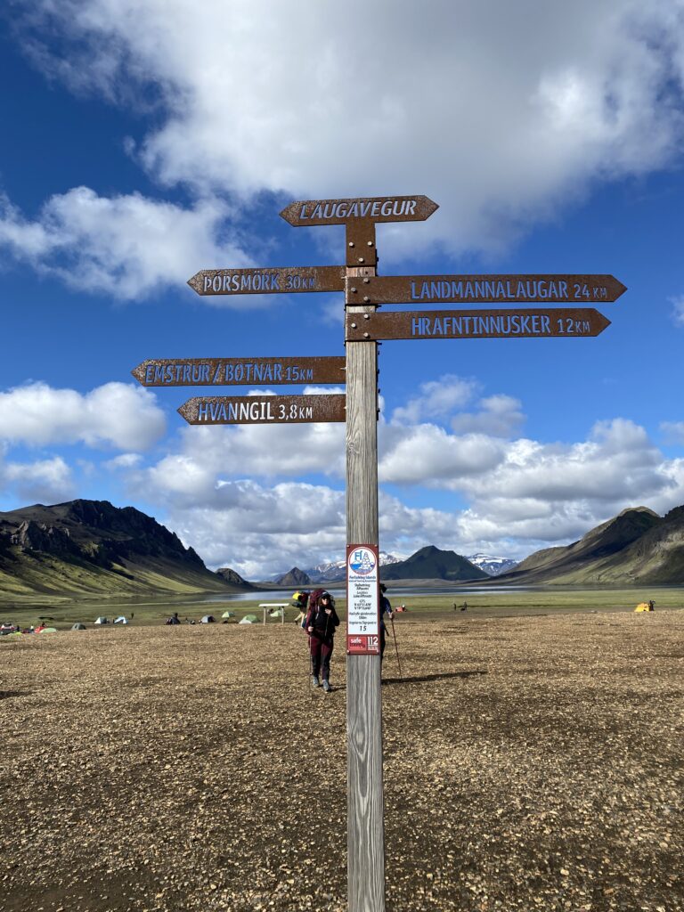
Due to the changeable weather these trails are rarely accessible outside of July and August so we chose the end of July in the hope that we would have the best conditions. The Laugavegur trail is 34.5 miles (55.5 km) long, and connects Landmannalaugar and Þórsmörk (Thorsmork) and the Fimmvörðuháls is an 18-mile (29-km) extension from Þórsmörk to Skogar. The authorities recommend allowing 4-days for the Laugavegur and 2-days for the Fimmvörðuháls but our schedule only allowed us a maximum of 5-days so we thought we might either need to forego the Fimmvörðuháls or put in a long day somewhere to squeeze both into just 5-days. As it happened, unfriendly weather forced us to make a choice between stopping after the Laugavegur or completing both trails in just 4-days. We did both trails in 4-days and this is our story.
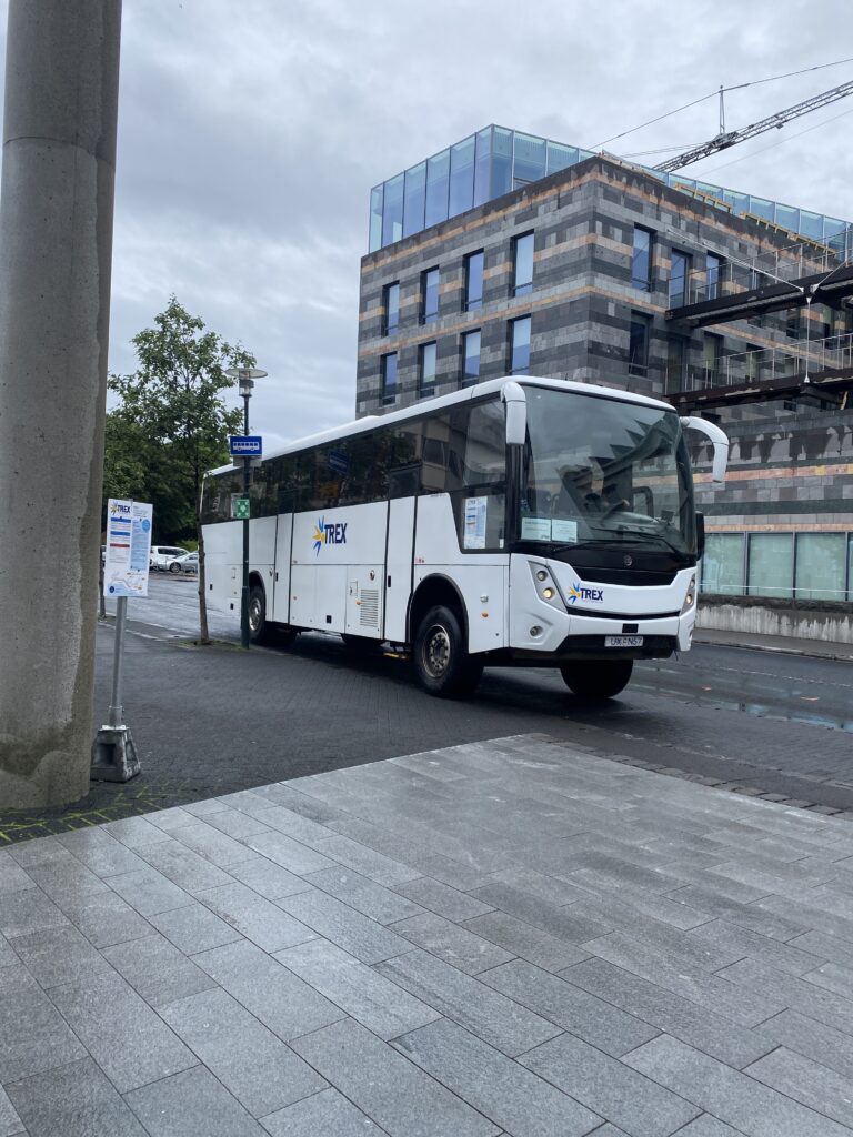
Reaching the start.
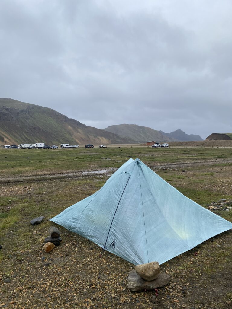
Travelling independently, we soon came to terms with the fact that our backpacks weighed about 18.5kg each and contained everything we would need. There would be no support on this adventure. We made our way to Landmannalaugar, 3hrs from Reykjavik on a raised suspension bus which had been adapted to deal with the river crossings and off-road tracks taking us to our overnight campsite which, despite being very remote, had good basic facilities and hot water thanks to the geothermal springs. In the days ahead we would look back at Landmannalaugar and think of it as the epitome of luxury, but on our first night it was simply the start of our adventure. We pitched our lightweight tent, cooked ourselves a simple meal, studied our map for the morning and got an early night. (24hrs of daylight did not prevent us from sleeping.)
Hike day 1. And we’re off!
We woke to a light drizzle and temperatures in single figures (deg C), had breakfast, packed away our tent and sleeping gear and set off by 0900. We decided that we would try to make this a long day of 24km (15miles) to give us a chance of doing both trails in the time we had, which meant reaching Alftavatn that night even though this was the stretch of the Laugavegur with the greatest altitude changes [550m up (1800ft) and 600m down (1968ft)].
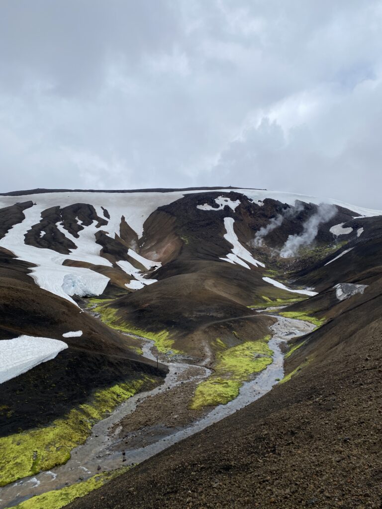
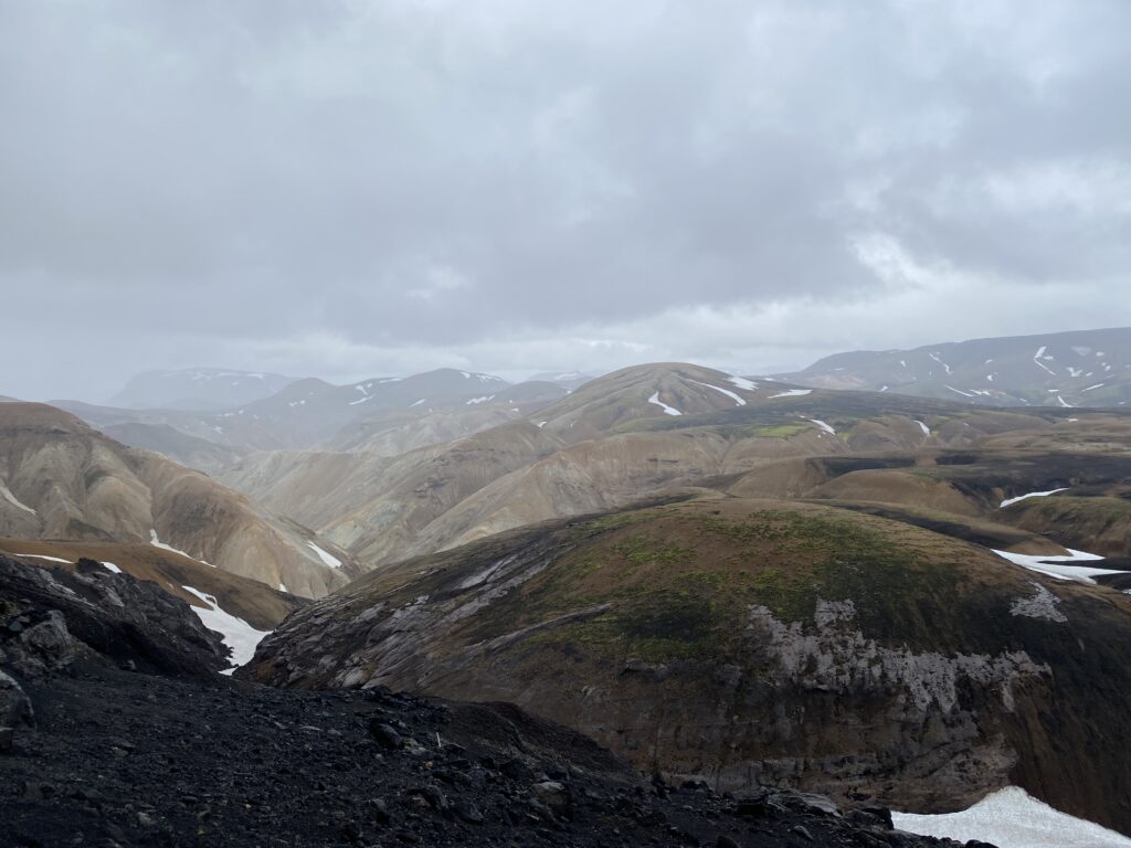
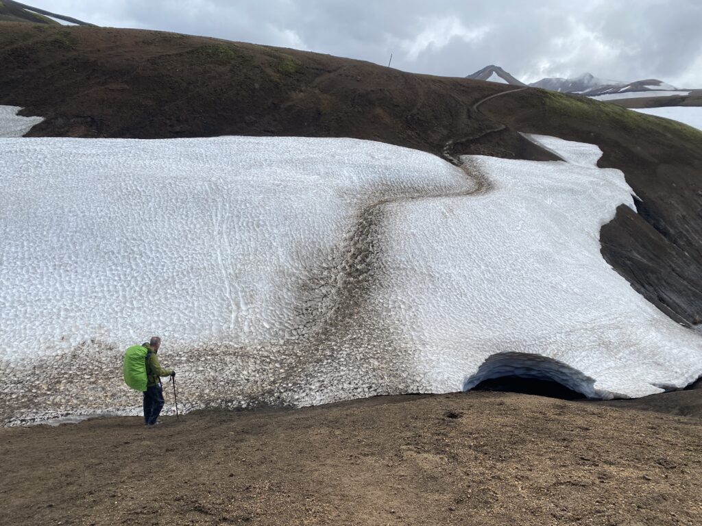
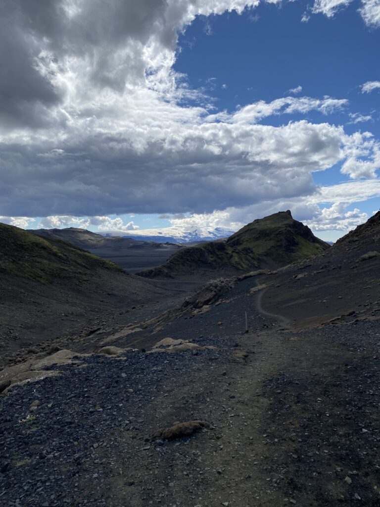
The first 12km was pretty much all uphill through the most amazing landscape of geothermal activity and expansive views. It wasn’t long before we came across our first snowfields which we found harder to cross than expected due to the weight on our backs and slushy snow underfoot which made every step quite tricky without spikes. Then the wind and rain began to make more of an appearance and our pace slowed quite dramatically. Once the weather closes in it can make it more difficult to follow the route but at no time on this section did we feel the need to refer to our map and compass. However, we passed a rocky monument to a 25yr old man who passed away in a blizzard in 2004 which was a stark reminder of the dangers. It was 1240 when we arrived at Hraftinnusker, halfway to our overnight destination and the 3hrs 40mins already walked felt much more like 10hrs!! After a short rest sheltering from the storm behind a hut to cook some lunch and drink tea, we set off again, grateful in the knowledge that it would be mostly downhill even if it would still be hard going. The weather continued to batter us for a few more hours but by 1600 it eased off and the sun came out just in time for us to tackle our first freezing cold river crossing. We dried off and continued on to reach Alftavatn at 1830, tired and quite surprised that we had only managed a rate of 2.5km/hr. Throughout our training in the UK we had been comfortably achieving more than twice that. Pitching our tent by the lake and finally resting our feet and shoulders was blissful and dinner of curry and rice tasted wonderful before another early night.
Hike day 2. A different landscape.
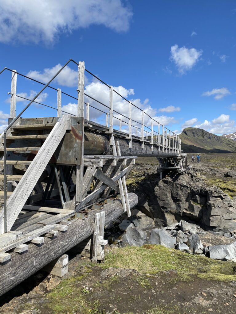
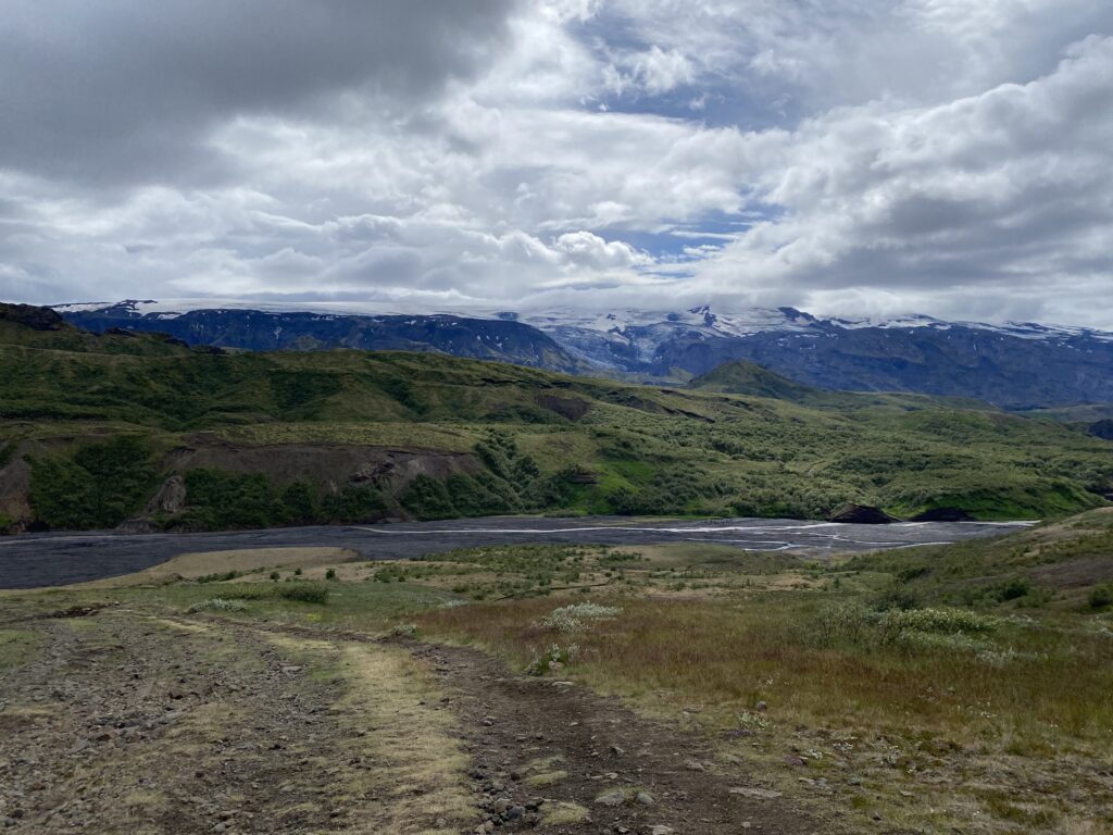
Breakfast of porridge with hot chocolate powder mixed in tasted great beside our tent looking out over the tranquil lake of Alftavatn. At just 16km (9.5miles), two river crossings and only 310m of elevation change (125m up and 185m down) the day ahead promised to be much easier. This was made even nicer by the arrival of better weather. We had a leisurely start, struck camp and set off at 1000 with the aim of reaching Botnar/Emstrur by 1600-1700. Heading due south and crossing a helpful bridge over a stream the trail rounds ridges to another river which we had to wade across. On the other side we headed uphill to Hvanngil where Iceland Touring Association operates a mountain hut with toilets and fresh water. In this remote part of Iceland these huts were amazingly clean. Better than anything you might find in a city centre. Soon afterwards we reached the second river with another helpful bridge from which we had amazing views across the plains formed by moving glaciers.
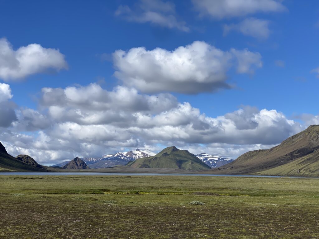
The next few kms were a vast section of black sands and scarce vegetation, one of the highland deserts. In contrast to the previous day’s cold and wet conditions we were in short sleeved shirts getting slowly baked by the sun overhead. There is a consistent but gradual uphill incline to this part of the trail which makes the views quite samey for a few hours but once at what we thought might be the highest point, we stopped and brewed up a hot drink and studied the map. This was already 1530 and we had travelled just 12km from Alftavatn in 5.5hrs. The river crossings slowed us down more than we realised and we still had 4km to go so we decided to try and up the pace. Within another km the landscape changed once again as we crossed another bridge and entered a lush region of green mountains with amazing views in all directions. Hardly a snow peaked glacier in sight and it was hard to believe that this was the same continent let along the same country. We then headed along a pass through the Útigönguhöfði mountains and commenced the 1hr downhill path to Emstrur Botnar which we reached at 1630, bang on schedule. The facilities at Emstrur Botnar were quite good, although we were surprised to find it busy with a tour group taking up almost every cm of available space. The warden gave us a nice plot in which to pitch our tent though and we made use of their luke warm showers to freshen up before enjoying another of our meals that we had preplanned weeks before.
Hike day 3. Finishing Laugavegur.
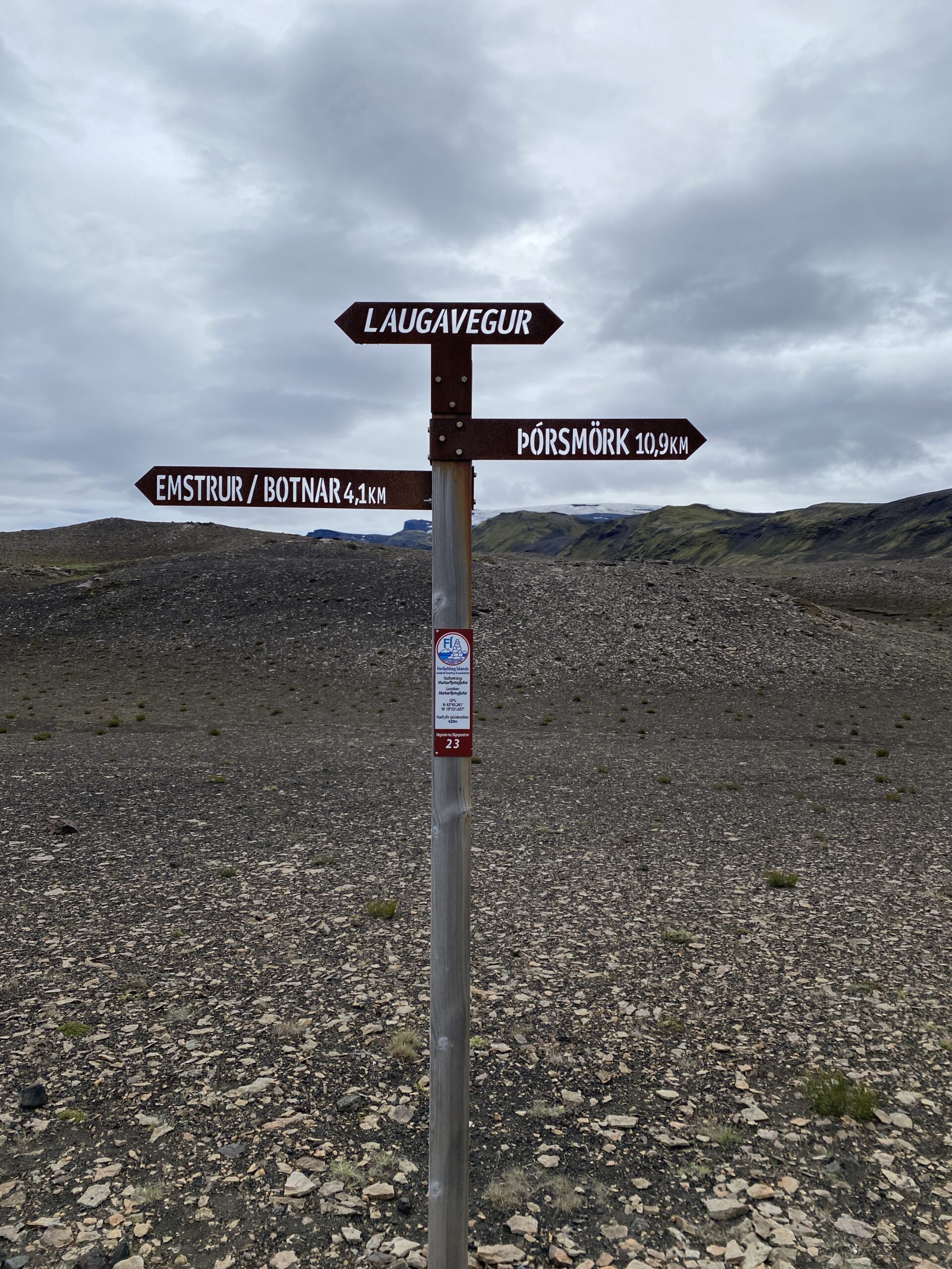
The target today was to reach Langidalur and finish the Laugavegur by about 1630 so that we could rest up before deciding how we should proceed.
Before we set off we checked the warden’s office noticeboard which had safety advice about this next section of our trail, predominantly concerning volcanic activity and what we should do if any geothermal excitement started. Apparently, prior to an eruption the ground heats up very rapidly and melts the glaciers causing sudden flooding to low lying areas. Then highly conductive volcanic ash is thrown into the air causing lightning strikes around the peaks, and in windless conditions toxic gases accumulate in hollows and depressions. It’s not clear what one should do in this situation so we agreed that we would try not to think too much about it and just get a move on!
Today’s distance to walk was 16km (10miles) but with lots of up and down climbing and two more river crossings. The elevation change in this stretch is about 800m so we were mentally prepared for a physical day even if our bodies didn’t seem to be so willing.
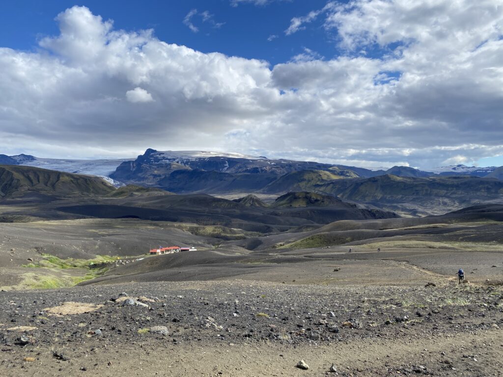
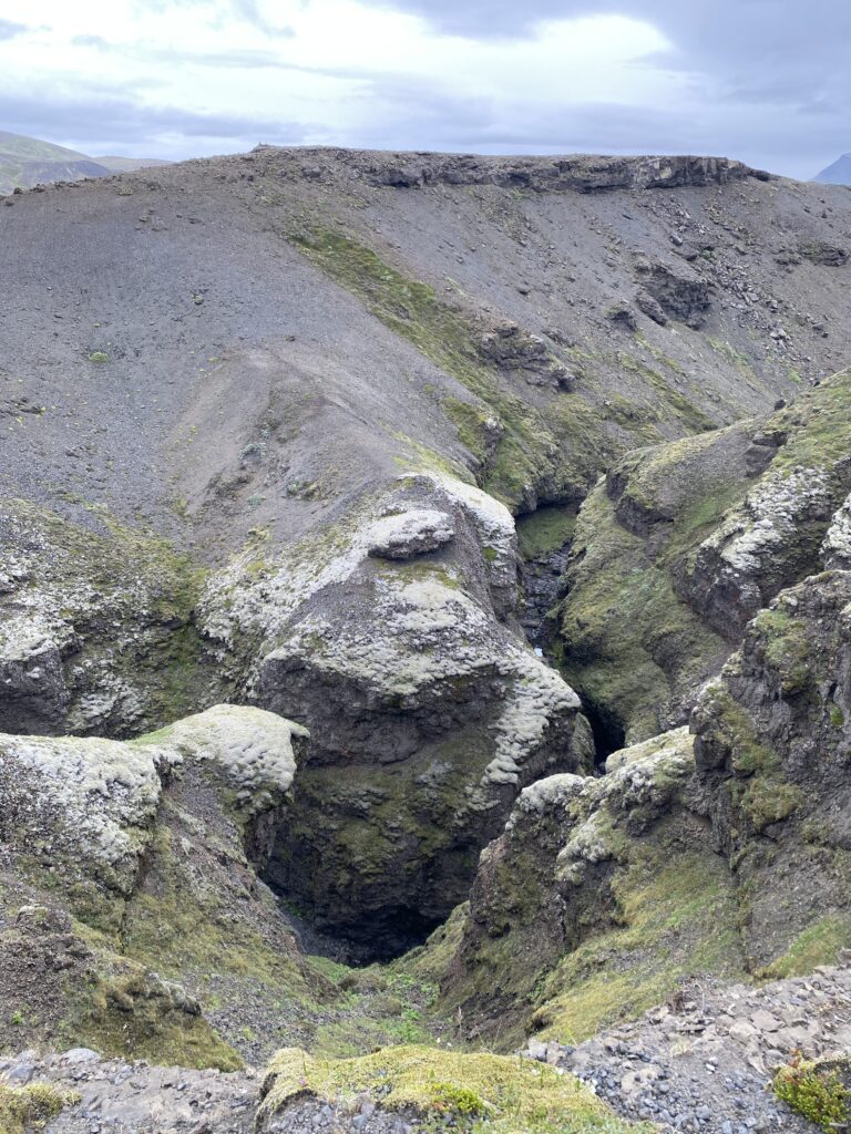
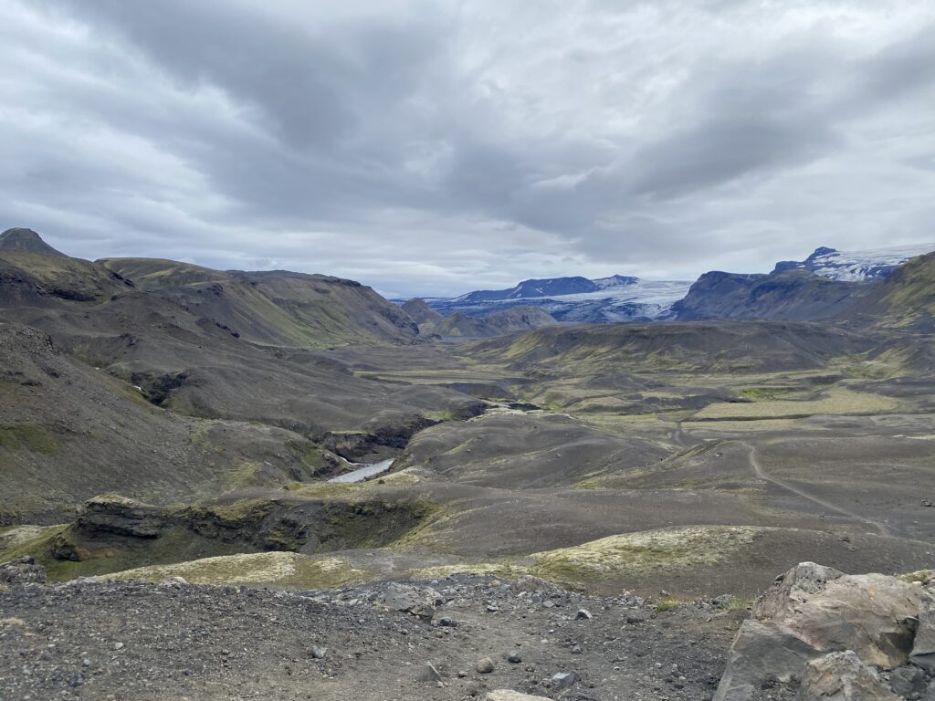
After yet another breakfast of porridge with chocolate we set off at our usual time of 1000 and headed into the Mýrdalsjökull glacier and over the Emstrur river. Although it was overcast and windy it was dry and the ground was mostly firm. The route took us along the north-western edge of this enormous glacier with far reaching views.
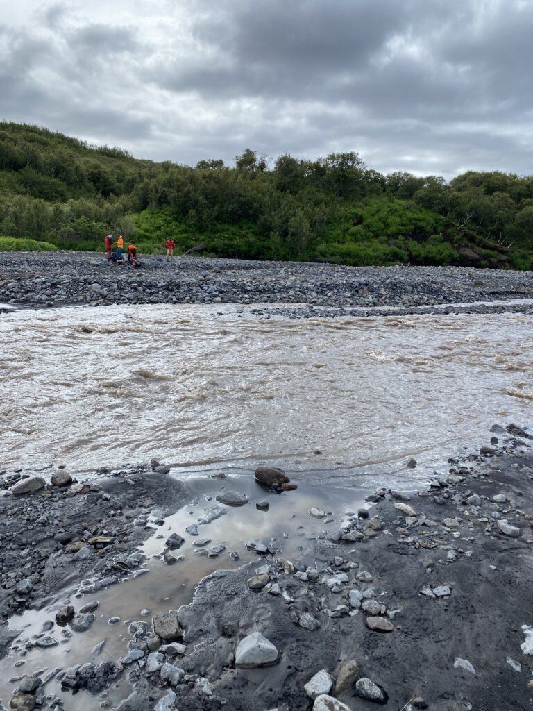
By mid-afternoon we came across another river to wade through which was fast flowing and looked quite challenging. As we rounded a corner towards it a giant of a man strode confidently towards us with his partner. We craned our necks to look up at him and asked how he had found the crossing. He paused for a while as if trying to remember if he had just stepped through a puddle and in a broad Scottish accent he said “Aye, it’s nay too ba’d, refreshingly cool and should only come up too ‘yer shin.” We looked at him (easily over 2.1m tall) then looked at Ioana (petite to say the least) and laughed. “Ioana, I think this might be time to put your shorts on!” Deciding that the example set by sea otters might be worth taking note of we held hands as we waded through. My goodness it was cold, but once we had changed back into our long trousers our feet felt fantastically refreshed and positively tingled with rejuvenation. At this point we met a lovely Icelandic couple, Celia and something unpronounceable that means cold wind in Icelandic (sorry) who gave us a few tips about the journey ahead and Ioana asked them why there were so few trees. They explained that this was a sore topic amongst Icelandic folks. The trees were felled about a hundred years ago and have never really reestablished, so they are introducing strategies to bring them back, but it requires control of mountain animals and farming which is why we hadn’t seen any goats or sheep. We wished each other well and we went our separate ways.
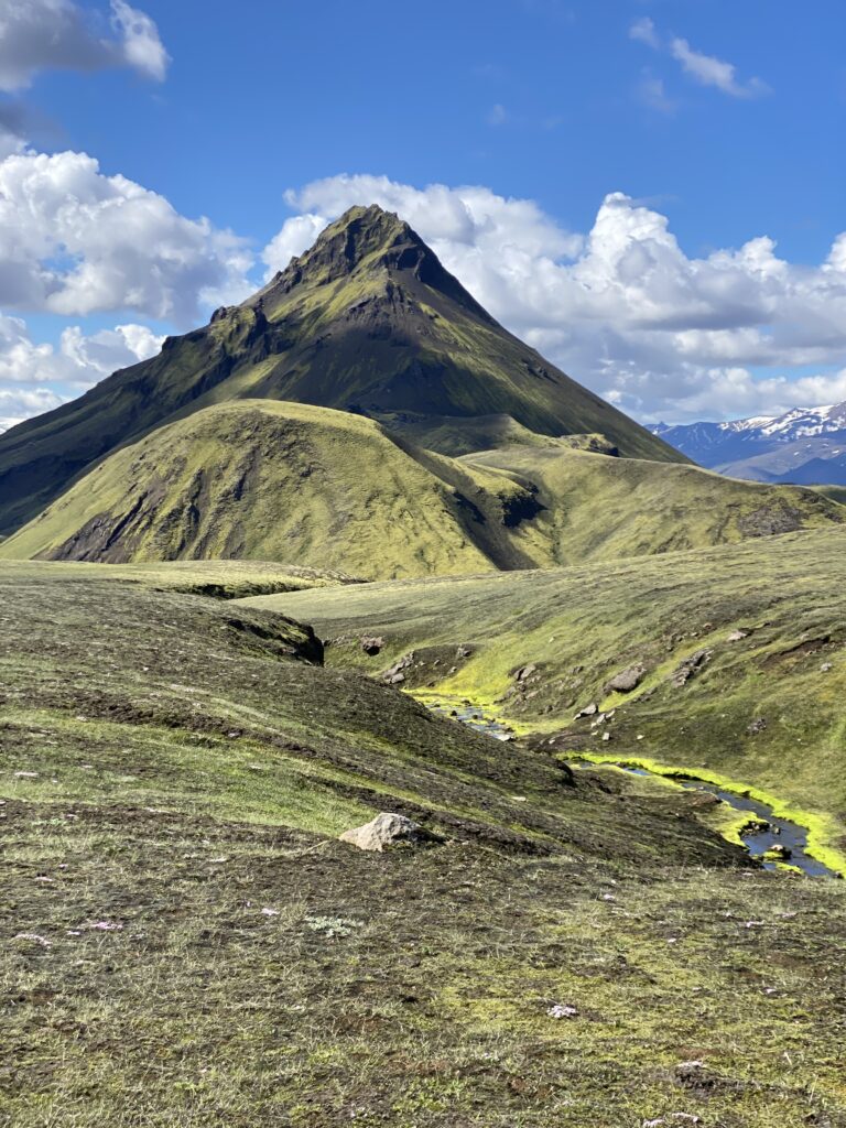
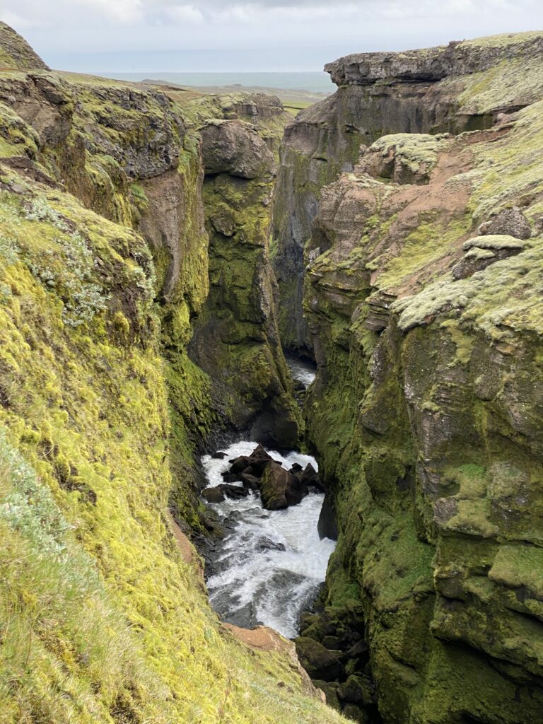
Almost immediately after the river crossing we headed upwards through a narrow pathway through young trees, shrubs and mountain flowers that gave off a beautiful aromas. The contrast between this and the black volcanic ash and sands that had been getting into our socks and boots for the last day was amazing. As we approached our campsite we heard the strange sounds of a bird which we later discovered was the Rjupa. This green pathway took us all the way to Þórsmörk at 1630 where we congratulated ourselves on completing the Laugavegur.
Our tent was pitched by 1700 and we celebrated with a dinner of real Italian Gnocchi which we had brought with us and seemed to be admired by the other hikers eating their rehydrated packet food.
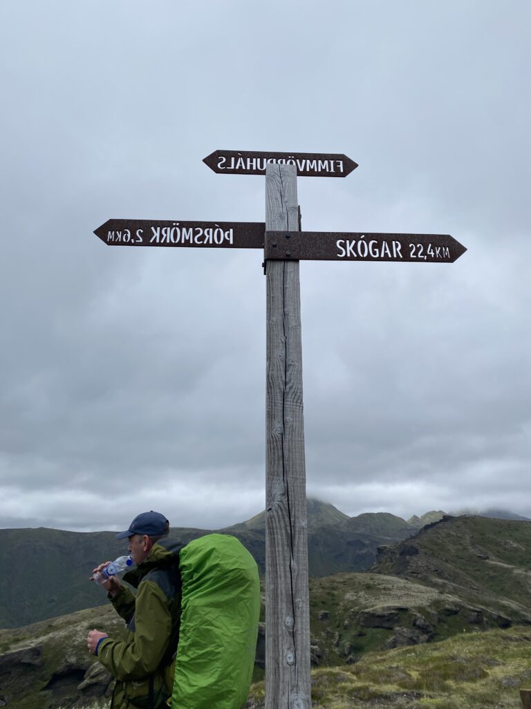
Hike day 4. The Fimmvörðuháls
The Fimmvörðuháls is a 29km (18mile) extension from Þórsmörk to Skogar, and we had been told that although it requires more fitness and nerve it is also the best part, and highly recommended if we had time, sufficient fortitude, and cooperative weather. The trail comprises a 914m (3,000+ ft) ascent, a narrow section called the Kattahryggur (cat’s spine), a cluster of sketchy parts called the Heljarkambur, and lots of mossy waterfalls. The pass between the volcanic snowcaps has large snowfields, high winds, and an amazing view out over the Atlantic Ocean. This is the region of the Eyjafjallajökull eruption that stopped global air traffic in 2010.
We woke up at about 0745 and took our time to have breakfast and deal with our various blisters and aching muscles. We were both physically shattered and mentally drained so we had a discussion about whether to finish our Icelandic adventure here or to continue to do the Fimmvörðuháls. If we are being totally honest with ourselves stopping was never much of a consideration, the only question really was how long we should allow to do it. 24hrs of daylight meant that we could take our time and the hut at Baldvinsskáli offered the possibility of taking shelter at the halfway point in an emergency. We had a chat with the warden at Langidalur and he said that the weather forecast was very poor and that we should get a move on if we wanted to avoid getting stranded on the mountains. He said that it was unlikely that we would be able to pitch a tent at Baldvinsskáli due to the high winds so we decided that we would try and complete the whole Fimmvörðuháls in a single day and then have a really good rest at Skogar afterwards.
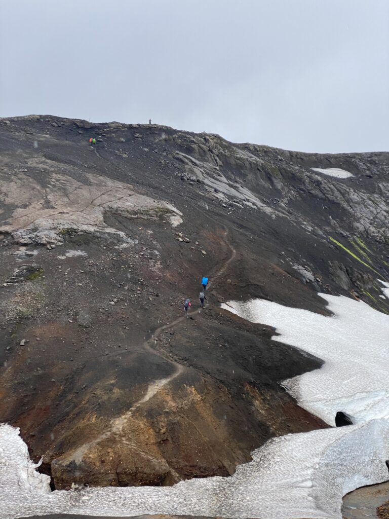
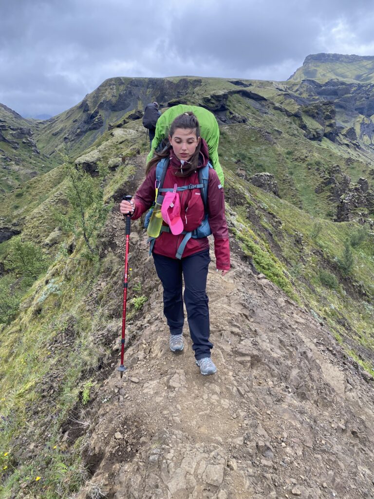
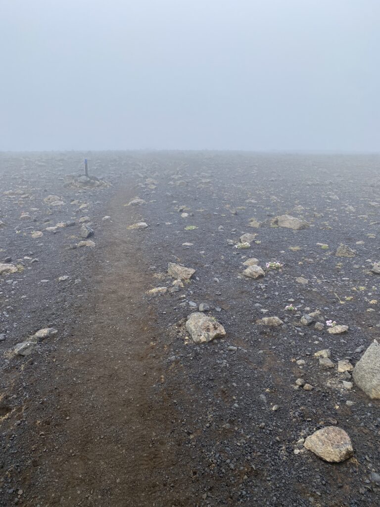
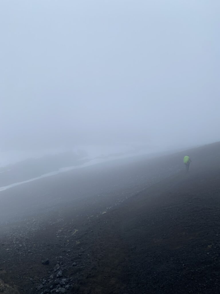
We set off at 0830 and spent the first hour stumbling over river washed boulders as we made our way to Básar the base of the mountains leading to the Eyjafjallajökull glacier. This area is called Goðalönd – the abode of the Gods. How apt. It was very windy and quite cool but we could see that at the higher altitudes it was gusty and very wet. Little did we know how bad it would become but we did know that we had a 900m climb right into the middle of it. Both of us found this very difficult with sections where we were climbing with hands as well as feet. The wet conditions caused the ground under foot to be unpredictable and extra care was needed to prevent serious slips and disaster but somehow we managed to keep going. It was exhausting and possibly made more psychologically challenging because we never lost sight of the trail ahead seemingly disappearing into the clouds forever. For 3hrs we hardly seemed to make much progress but we willed each other on and maintained a sense of humour which is so very important. It was 1130 when we finally reached the Cat’s Spine, a narrow ridge with a steep drop on either side which would result in almost certain injury if you lost your footing. The wind was gusting at about 60km/hr and the rain and hail meant that it was slow to get across. We decided to cross separately to prevent distractions caused by worrying about each other. Shortly after this was the Devil’s Crest, another perilous ridge but this was slightly wider and easier to traverse and immediately afterwards there is a steep but short narrow climb up a slippery rockface that had a chain onto which you can hold for stability and support. This was slippery because of the rain but fortunately neither of us have a problem with heights and we were able to focus on our progress rather than the fear of falling. This proved to be the highest point of the climb but once over the pass we were hit by the full force of the winds and rain and visibility dropped to about 60m just as a new weather phenomenon introduced itself to us; hailstorms of tiny ice needles piercing our faces. This was the region of the lava fields created during the 2010 volcanic eruptions, so the hail was mixed with windborne black dust that made it difficult to keep your eyes open. At this point the fog and strong winds descended again, this time gusting at about 100km/hr, but after a brief moment crouching down to hide from the elements, we soon made our way forward. Fortunately, the route across this region is marked at about 150m distances with yellow plastic posts so it was easy to maintain a bearing, or so we thought.
As we headed into snowfields towards what we believed to be the right direction visibility dropped to just a few metres and it wasn’t clear which route we should take. We could see footprints in the snow going in two different directions and it wasn’t really possible to get a map out as it would quite possibly have ripped and blown away. We should have risked it though because at this point, we made a mistake that could have been disastrous and made a wrong turn. We lost sight of our marker posts and picked up a different trail. Exhausted and worried, we soon knew that it wasn’t right, and we huddled together in the storm to decide what to do. Retracing our steps was still an option but if we went on much further this would become more difficult. At that moment the wind suddenly dropped, and visibility cleared to about 750m and we happened to be looking in exactly the right direction to see a tiny yellow marker post about 0.5km away. This soon disappeared into the mist, but we had a bearing and after about 30 minutes we found our way back to the correct trail and were very relieved. But the Fimmvörðuháls doesn’t let you rest on your laurels for long and just as our confidence levels started to grow, we crossed a snowfield and came across a 45° wall of ice covered rock about 10m high which we needed to climb. This wasn’t expected and we didn’t have crampons or spikes, but we had no choice but to overcome the obstacle. We picked our route and tentatively began to climb it. Amazingly, this ice face had tiny pieces of gravel embedded in it which meant that although it was obviously slippery, our boots had just enough to grip onto and we were able to use our trekking poles as ice-axes to dig in and lever ourselves along. We were rewarded for our efforts by discovering that the temporary respite of the wardens hut at Baldvinsskáli was just 0.5km away so we sped on, collapsed into their warm shelter to make some tea, and cooked our lunch. We were so proud of ourselves but were absolutely shattered. It’s amazing how quickly you can revive yourself with a few calories of hot food and a cup of tea and hearing a few words of reassurance from someone like the hut warden. She told us that we had done amazingly to reach the hut from Landmannalaugar in just 3.5days and that usually only the Icelandic people achieve that. This was exactly what we needed to hear, and her encouragement gave us the energy boost we needed to continue. It was 1700 when we left, and we guessed we had another 3 or 4hrs to go, all the time seeing better weather at a lower altitude, and we felt that our raingear was no longer needed.
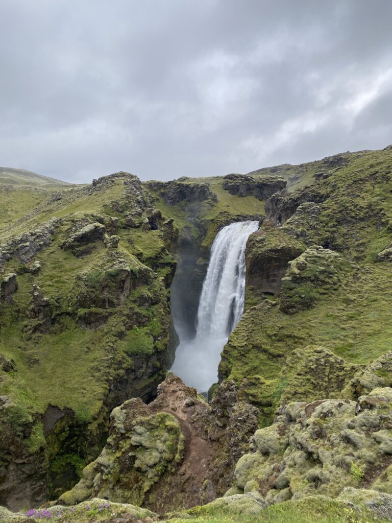
By this point we were running on empty but the gorgeous views of 23 breathtaking waterfalls and the improving weather made it more than bearable, it was wonderfully enjoyable. This is what we came for.
We finally dragged ourselves into Skogar at 2130 where we pitched our tent, cooked our final evening meal, and settled down for the night to enjoy our achievements in the knowledge that we didn’t need to do anything else tomorrow except find a bus to take us back to Reykjavik.
Going home
There are two buses from Skogar to Reykjavik, but the journey time is about 7hrs and you arrive at the same time whichever one you take because the earlier one has a 5hr stopover enroute. We decided to take the earlier bus rather than stay at Skogar and risk the later bus having delays or being full and we bought ourselves a simple dinner to eat in our hotel. It was budget lodgings but the hot shower, fresh towels and a comfortable bed made it a perfect way to end our trip to Iceland..
We flew back home the next day and we were back to work as if nothing had happened 8 days after we left the UK.
A few retrospective thoughts
Iceland was everything we hoped it might be and so much more. Tackling the L & F trails in 4 days was probably too ambitious but even if we had had more time the weather would have prevented us from pitching tents at intermediate sites and so we would have had to have rest days when no progress could have been made. Therefore, we would have had to do the hike with 6 days of walking and perhaps 2 or 3 rest days waiting for the weather to improve.
We definitely reassured ourselves that we have the required fitness and mental strength for Mt. Toubkal, but more importantly we proved that we can endure almost anything thrown at us without falling out or arguing. At no point did we fail to support each other and maintain our sense of humour and encouragement.
Would we do it again? Only if someone wanted to sponsor us to do it and give generously to our charities. I don’t think we would do it again purely for fun but ask us again in a couple of years.